

Hurricane Melissa Wind gusts reached record speeds shortly before the storm made landfall in the Caribbean last month, according to data recorded during the deadly event.
The data was collected when a NOAA Hurricane Hunter aircraft dropped a fleet of weather instruments into the raging storm. according to press release from the US National Science Foundation's National Center for Atmospheric Research. The devices, called dropsondes, have small parachutes attached to them and take two to four readings per second before falling into the ocean.
Dropsondes are the only devices that can simultaneously record pressure, temperature, humidity and wind information. The data is used in forecasts and weather warnings, including emergency alerts.
“When you're looking at a Category 4 or 5 hurricane, you won't see aircraft flying that close to the surface—that would be completely unsafe—but you need to know what's happening near sea level because that's where people and property are most affected,” NSF NCAR engineer Terry Hawk, who manages the Dropsonde program, said in a press release. “The drop probe gives you information that you can't get any other way, and that's why it's been around for decades.”
One dropsonde used during Hurricane Melissa recorded a wind gust of 252 mph shortly before hitting the ocean.
Holger Voehmel/NSF NCAR
NOAA researchers contacted NSF NCAR to confirm that this was the highest wind speed ever recorded by a dropsonde.
“NOAA contacted us when they saw the high wind speeds and asked, 'Are these numbers good?'” said Holger Voehmel, a senior scientist at NSF NCAR working in the organization's Dropsonde program.
To verify the data, Föhmel and other researchers analyzed the numbers using quality control software. They also confirmed that the reported 252 mile wind gust was physically possible and that it was consistent with hurricane behavior as well as previous storms. The test confirmed the accuracy of wind gust measurements.
The previous fastest gust recorded by a dropsonde was in 2010, when Typhoon Megi exploded at 248 mph over the Western Pacific Ocean. For Hurricane KatrinaThe researchers thought they had captured an even stronger gust, but the data had significant problems, NSF NCAR reported.
NOAA/NESDIS/STAR GOES-19 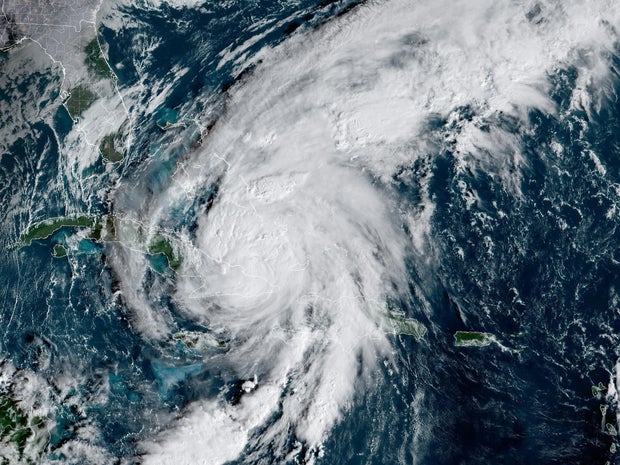
“They have pilots and researchers who are literally risking their lives to get these measurements. They are heroes, and we are honored to play our part in ensuring the accuracy of their measurements,” said Fehmel.
Hurricane Melissa caused catastrophic damage to the Caribbean Sea in late October. It did landfall in Jamaica as a Category 5 storm and then spread to Cuba, the Bahamas, the Dominican Republic and Haiti. Dozens of people, mostly in Jamaica and Haitidied during the hurricane.


