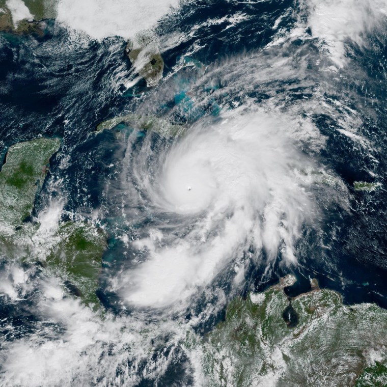
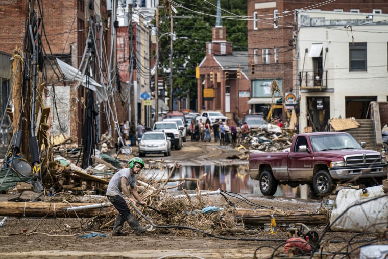
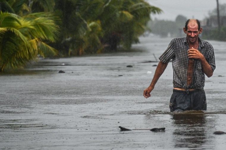
Hurricane MelissaThe hurricane that struck Jamaica and Cuba over the past two days followed what has unfortunately become a familiar pattern for major storms in a warming world.
The most catastrophic storms—those with the strongest winds and heaviest rain—were once rare, but are becoming more likely due to climate change. And similarities also emerge in the behavior and timing of these powerful hurricanes.
Before Melissa struck Jamaica as a Category 5 monster, it raged in particularly warm waters, like other hurricanes over the past decade. This allowed it to strengthen at a rapid pace, becoming the most powerful of this year's Atlantic season and setting the record for the strongest landfall in Atlantic history.
The storm then slowed, giving more time for heavy rain to fall on Jamaica, another sign of hurricanes on a warming planet. Melissa's timing was also notable: it formed late in the season (hurricane activity is generally considered to peak in early September) as ocean warmth persisted into the fall.
Taken together, this behavior makes Melissa something of a poster child for hurricanes' new normal, experts say.
“These storms are not what they were a couple of decades ago,” said Shel Winkley, a meteorologist with the nonprofit research group Climate Central.
It's a shift with life-and-death consequences that is now being closely watched by forecasters and officials in storm-prone areas.
Gaining in a hurry
One of the most amazing things about Melissa is how quickly she intensified. It upgraded from a tropical storm to a Category 4 storm in just 18 hours on Sunday before reaching a Category 5 storm early Monday.
Climate change increases the risk of this “rapid intensification” pattern, which the National Hurricane Center defines as an increase in sustained wind speeds of at least 35 mph over a 24-hour period.
In Melissa's case, Winkley said, unusually high sea surface temperatures in the Caribbean and high levels of atmospheric humidity caused an “extremely rapid intensification.”
“We're really good at predicting and understanding when hurricanes will significantly increase in intensity, but in the case of Melissa, it even surpassed the best forecast we can make for it in terms of wind speed,” he said.
Winkley added that the storm passed over Caribbean waters that were 2.5 degrees Fahrenheit warmer than normal. climate change has become 700 times more likely.
Two and a half degrees Fahrenheit may not seem like much when it comes to a giant hurricane, but a small temperature difference can really make a big impact,” Winkley said.
Many other recent storms have intensified dramatically. Last year, Hurricane Milton's winds increased by 90 mph in about 25 hours, and in 2022, Hurricane Ian went through two stages of rapid intensification before making landfall in Florida. The list goes on: Hurricanes Idalia in 2023, Ida in 2021 and Harvey in 2017 also experienced dramatic intensification.
Fewer hurricanes, more consequences
Over the past 35 years, the number of hurricanes and tropical cyclones that form each year has been declining.
“We found that the number of hurricanes worldwide, including typhoons, has declined significantly since 1990,” said Phil Klotzbach, an atmospheric scientist who studies hurricanes at Colorado State University.
But that overall decline is largely due to a drop in cyclone activity in the Pacific, Klotzbach said; Atlantic hurricane activity has increased primarily as a result of the decades-long trend toward La Niña, a seasonal circulation pattern that tends to weaken the high-altitude winds that prevent hurricanes from forming.
“La Niña is good for the Atlantic if you like hurricanes,” Klotzbach said.

When hurricanes do develop, they are more likely to develop into severe storms as seas warm.
“We are seeing an increase in the number of those reaching categories 4 and 5,” Klotzbach said.
Melissa became the third Category 5 hurricane this year, the first time in two decades that more than two hurricanes of that strength have formed in one season.
Zachary Handlos, an atmospheric scientist at Georgia Tech, said that while warmer seas will be more conducive to hurricanes in the future, a warmer atmosphere will cause changes in high-altitude winds that could prevent or destroy hurricanes. Those winds may strengthen in some places and weaken in others, he said: “It's not a very simple answer.”
How these trends will develop remains an active area of research and scientific debate.
Longer hurricane season
It wasn't lost on experts that the biggest hurricane of the season hit just days before Halloween.
“It's pretty late in the season at this point. Things should start to wind down,” said Derrick Herndon, a researcher with the Tropical Cyclone Research Group at the University of Wisconsin.
The Caribbean has always been a hot spot for powerful late-season hurricanes, but they are becoming even more likely, Klotzbach said – he recently presented a study showing the trend for peer review. At the same time, data on hurricanes in the era of satellite observations (from 1971 to 2022) suggests hurricane season starts earlier also in the year.

The fall hurricane pattern is driven by a long-term trend toward a La Niña pattern, which itself is likely the result of a combination of climate change and natural variability, Klotzbach said.
He said La Niña weakens high-altitude winds at a time when Caribbean waters are still hot, setting the stage for storms in late October and early November: “It increases the likelihood of these strong hurricanes.”
Hurricane Melissa added to warmer-than-normal waters off the southern coast of Jamaica.
“If there's a really strong hurricane in the Atlantic, it's more likely to be in this part of the world,” Herndon said.
In the past, such a storm would typically push cold water up from the surface and suppress its own growth, according to Andy Hazelton, a hurricane modeler and postdoctoral fellow at the University of Miami's Cooperative Institute of Marine and Atmospheric Science. But this year, ocean temperatures are warmer both at the surface and down to 200 feet deep, he said, so Melissa simply produced more heat and energy.
The storms drag on
Just before or after landfall, hurricanes are now more likely to stall and dump massive amounts of rain, according to the study. published last year. Other studies show that they forward speed has become slower in general, although this remains a topic of debate.

Hurricane Melissa followed suit, stalling off the coast of Jamaica and continuing to gain strength. On Tuesday morning, the day of his first landfall, the storm was moving at about 2 miles per hour. Forecasters expected parts of Jamaica to receive up to 30 inches of rain, more than a third of the annual average.
Scientists don't agree on why some storms move more slowly, but some suggest it's because climate change has weakened atmospheric circulation patterns.
Hurricane Harvey in 2017 was a dramatic example of the consequences of this delay: as it stalled over Houston, the hurricane About 5 feet of rain fell in some places.. This pattern is especially problematic because a warmer atmosphere can absorb and carry more precipitation.
“For every degree Fahrenheit warming, the atmosphere can hold 4% more moisture,” Winkley said. “Warmer oceans not only increase the intensity of hurricanes, but also promote more evaporation, so they release more rain-producing moisture into the atmosphere for these hurricanes to absorb and then release.”


